

Baurtregaum [Barr Tri gCom]
Good walks are even better shared.
Q7407 : A foggy day on the summit of Baurtregaum, Slieve Mish
Colin Park Photo source
Overview
Baurtregaum [Barr Tri gCom]
Baurtregaum is the highest mountain in the Slieve Mish range on the eastern Dingle Peninsula, County Kerry. Current DoBIH records 850 m and 644 m prominence. The trig point stands in a depression; its base should not be treated as a surveyed natural high point. Primary record
Walking
The supported route is a hard 11.5 km circuit from Derrymore Glen via Caherconree and Baurtregaum, returning beyond the NE Top and across the river to the outward path. The total excludes Caherconree’s fort detour. It is a mountain route with steep pathless ground, broken rock, dense vegetation and a condition-dependent river crossing. Carry navigation equipment and turn back if the terrain, water or weather is unsafe. Complete route
Landscape and names
The Slieve Mish mountains are mainly Devonian Old Red Sandstone, with glaciated valleys on the northern side. NPWS account
Barr Trí gCom means “top of three hollows”; the identification with Derrymore, Derryquay and Curraheen is a suggestion rather than a certainty. Authored name and landscape account
Planning
Use the northern Derrymore approach near Camp, not the imported Glenbeigh or Sally Gap directions. Parking is limited and must not obstruct local access. Bus Éireann’s 275 serves Camp, but a connection to the trailhead needs separate planning. Do not rely on mountain-side refreshments or toilets. Bus route
Sources checked 18 October 2026. Older route sources use 851 m; the existing current-primary 850 m record and imported survey provenance are retained.
Explore routes near Baurtregaum [Barr Tri gCom]
Walks starting near this hill. Open a route to check its map, distance and full itinerary.
Route planning notes
These notes describe possible approaches. Check a route's map and access information when planning your walk.
Caherconree and Baurtregaum from Derrymore Glen
Wild Irish Walks records an 11.5 km full loop from the lane above the N86 near Camp: Derrymore Glen and lakes, steep westward climb to Caherconree, Baurtregaum, then descent beyond its NE Top, river crossing and return along the outward valley path. The fort detour is excluded. This is hard, partly pathless mountain walking. Source: https://wildirishwalks.ie/caherconree-and-baurtregaum-loop/
Make a day of it, together
Find someone to share the walk with, or organise a day out along a route you like.
Photo Gallery
View all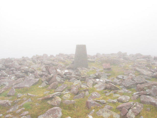 Photo could not load
Q7407 : A foggy day on the summit of Baurtregaum, Slieve Mish
Colin Park
Hill facts and local notes
Classifications
Elevation
850m
2,789 ft
Prominence
644m
Coordinates
52.2071, -9.8295
Q749076
OS Map
71
At the Summit
DoBIH records a trig point at Q7498307667 and notes that it stands in a depression. Do not assume the ground immediately beneath the pillar is the natural high point.
Terrain & Geology
NPWS describes the Slieve Mish range as mainly Devonian Old Red Sandstone, with a band of Ordovician metasediments on its western slopes. Deep glaciated valleys cut the northern side. This is regional geology, not a new summit rock survey.
Views & Scenery
Clear conditions give views over the Slieve Mish mountains and north towards Tralee Bay. Cloud can completely obscure the summit outlook.
History & Heritage
Name Origin
Barr Trí gCom means “top of three hollows”. Stephen Murphy’s route account suggests Derrymore, Derryquay and Curraheen as the hollows; that identification is tentative.
Getting There & Facilities
Parking
The documented Derrymore loop starts on a narrow lane off the N86 near Camp. There is no formal car park in that account and roadside space is limited. Park only where permitted without blocking gates, homes or farm access; a different start changes the total distance.
Public Transport
Bus Éireann route 275 runs between Tralee and Dingle via Camp. It is not a verified trailhead service: check the current timetable and arrange the onward connection rather than assuming a safe walk along the N86.
Nearby Facilities
No toilets or refreshments at this mountain trailhead were verified. Carry food and water and arrange facilities before setting out.
Safety Information
Known Hazards
- Beyond Derrymore Lough, the published loop crosses steep ground without a defined path. Navigation skills and a map and compass are essential.
- The descent beyond the NE Top has steep broken rock, followed by thick heather and gorse and slippery wet ground.
- The loop requires a river crossing. Do not attempt it in high or fast water; assess conditions before committing to the circuit.
- Strong wind and low cloud can make the exposed upper ground difficult. Turn back if conditions exceed your skills.
General Safety Tips
- Check weather conditions before setting out
- Carry appropriate clothing and equipment
- Let someone know your planned route
- Take a map, compass, and GPS device
- Carry emergency supplies: food, water, first aid kit, torch
Hills
Some common questions about the hills answered
Are there group walks up Baurtregaum [Barr Tri gCom]?
Many walkers use Walkmates to join or organise walks with others. You can check for group walks around Baurtregaum [Barr Tri gCom] through the maps
Are there other walkers around Baurtregaum [Barr Tri gCom]?
Activity varies by location and time, but Walkmates lets you see whether others have shared walks or shown interest in this area. Find other people through the walking friends search walking friends for Baurtregaum [Barr Tri gCom] search or of course create your own walk for Baurtregaum [Barr Tri gCom]
Can I organise a walk to Baurtregaum [Barr Tri gCom]?
Yes. If there aren’t any walks listed already, you can create a walk and make it available for others to join.
If you're signed up to Walkmates, you can create a walk to Baurtregaum [Barr Tri gCom].
How do I find a walk up this hill?
There are often multiple ways to walk this hill, depending on experience and route preference. Walkmates helps you explore walks and routes that others have shared.
Can I suggest a new route up Baurtregaum [Barr Tri gCom]?
Yes. You can suggest or create routes to share with others. Walkmates focuses on the social side of walking, so routes are used to help people organise walks and explore areas together, rather than as detailed navigation tools or route libraries.
Other uses really appreciate knowledgeable walkers sharing their routes. Share your favourite route to Baurtregaum [Barr Tri gCom] here
The is an error or something incorrect about this hill. How do I let you know?
We always strive to keep the information on Walkmates as accurate as possible. If you find an error, please let us know through the contact form and we'll aim to correct it as quickly as possible
Community Discussion
Comments
Location
![Baurtregaum [Barr Tri gCom] location map](https://cdn.walkmates.com/hill-maps/hill-sources/20015/52.20706_-9.82952.png)
Grid reference: Q749076
View on OpenStreetMapOpens a map in a new tab, centred on the hill.
No comments yet. Be the first.